 WIND RESOURCE ASSESSMENT REPORT
WIND ENERGY DEVELOPMENT IN KARGIL
Wind Energy Development in
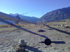
Kargil has been initiated by the demonstration projects established by Kargil Renewable Energy Development Agency (KREDA)
under the guidance of the National Institute for Wind Energy (NIWE), an autonomous
organisation established under the MNRE, in five most windy places of the
district.
Five candidate sites in
Kargil with 50m wind masts installed for wind resource assessment:
|
S.No.
|
SITE NAME
|
BLOCK
|
EXECUTING
AGENCY/COMPANY
|
|
01
|
Khumbathang
|
TSG
|
NIWE in collaboration with Ramakrishna
|
|
02
|
Photang
|
Zanskar
|
NIWE in collaboration with Ramakrishna
|
|
03
|
Rangdum
|
Tai-Suru
|
NIWE in collaboration with Ramakrishna
|
|
04
|
Hambutingla
|
Kargil
|
NIWE in collaboration with Ramakrishna
|
|
05
|
Lakhthang
|
Drass
|
NIWE in collaboration with Ramakrishna
|
The monitoring heights of the basic/optional
parameters at all the five sites in District Kargil:
|
S.No.
|
Parameters
|
Unit
|
Monitoring
Heights
|
|
01
|
Wind Speed
|
m/s
|
10m, 30m, 50m
|
|
02
|
Wind Direction
|
Degree
|
30m, 50m
|
|
03
|
Temperature
|
(°C)
|
03m
|
|
04
|
Pressure
|
Mb
|
03m
|
|
05
|
Solar Radiation
|
w/m²
|
03m
|
|
|
Note: Each site
has same parameters at same heights.
|
Status
of Wind Resource Assessment in Kargil:
As per the directions and
guidance of the team from NIWE our agency has been looking after the masts/stations.
Since the installation of the masts in October 2010 the officials have been
replacing the Multi Media Cards (MMC) and batteries each month, and along with
the Chip Collection Report send to NIWE for assessment.
Detailed
Physical achievement/status reports of Wind Energy at various sites in Kargil:
|
S.
No
|
Project
Sites
|
Coordinates
|
Status
|
|
01
|
Hambutingla
Kargil
|
Latitude: 34˚35ˊ02.4”N
Longitude: 76˚16ˊ30.5”E
|
Mast installation work was
completed on 21/10/2011.
So far two year data has
been collected.
The data logger is
collected from the station as the target period for 2 years data collection
has been completed.
|
|
02
|
Khumbathang
TSG
|
Latitude: 34º23’51.4”
Longitude: 75º59’47.8”
|
The wind mast installation
work has been completed on 16/10/2011.
So far two year data has
been collected.
The data logger is
collected from the station as the target period for 2 years data collection
has been completed.
|
|
03
|
Photang
Zanskar
|
Latitude: 33º29’19.9”
Longitude:
76º53’4.8”
|
The mast erection work has
been completed on 17/10/2011.
So far two year data has
been collected.
The data logger is
collected from the station as the target period for 2 years data collection
has been completed.
|
|
04
|
Rangdum
Tai-Suru
|
Latitude: 34º02’8.4”
Longitude: 76º22’25.2”
|
Mast installation work has
been completed on 21/10/2011.
So far two year data has
been collected.
The data logger is
collected from the station as the target period for 2 years data collection
has been completed.
|
|
05
|
Lakhthang
Drass
|
Latitude: 34˚25ˊ30.7”N
Longitude: 75˚43ˊ50.5”E
|
The wind mast installation
work has been completed on 22/10/2011
So far two year data has
been collected.
The data logger is
collected from the station as the target period for 2 years data collection
has been completed.
|
Wind Characteristics: The Average Wind Speed and
Wind Density at various heights (Based on Oct 2011 to
Aug 2012)
for the five sites is given below:
|
Station
|
50 m
|
30 m
|
10 m
|
|
WS
|
WPD
|
WS
|
WPD
|
WS
|
WPD
|
|
(m/s)
|
(W/m²)
|
(m/s)
|
(W/m²)
|
(m/s)
|
(W/m²)
|
|
Hambutingla
|
4.07
|
90.09
|
4.05
|
96.19
|
4.41
|
115.92
|
|
Lakhthang
|
3.17
|
60.10
|
2.87
|
48.97
|
3.03
|
48.17
|
|
Khumbathang
|
3.03
|
67.65
|
2.79
|
60.35
|
2.77
|
46.12
|
|
Rangdum
|
3.08
|
48.16
|
3.09
|
44.21
|
2.91
|
35.81
|
|
Photang
|
4.80
|
161.15
|
4.58
|
144.69
|
3.90
|
86.86
|
For more info
Contact:
sahilsheen@gmail.com |